Abstract
Total duration (RT): 4h (Fachoda basins) / 4h (Loti waterfall)
Total distance (RT): 10.2km (Fachoda basins) / 9.8km (Loti waterfall)
Positive elevation: 600m (Fachoda basins) / 200m (Loti waterfall)
Difficulty: difficult
Guide: recommended
Ascent of the river by track then path.
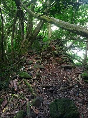
Trail not always well marked.
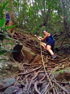
Steep sections with ropes to access the Fachoda basins.
A few fords to access the bottom of the Loti waterfall.
Warning, usually weak GPS signal.
Track
Open track with OpenRunner (Fachoda basins)
Open track with OpenRunner (Loti waterfall)
Open tracks with uMap
Open tracks with Google Maps
Download GPS tracks
Hike description
Access to the Fautaua valley is regulated, since the path is owned by the Polynesian des Eaux.
To obtain the access authorization, you must contact the "Direction générale des services" of the city hall of Papeete,
located on the first floor. Pay attention to opening hours (weekdays only).
Admission is 600 CFP per adult and 150 CFP per minor child. It is nominative and for a given date.
If you were unable to do the hike due to weather conditions or some other reason, the date may be postponed.
As the trails are not always well traced or marked, it is still recommended to get a guide to hike in the Fautaua valley.
To get to the start of the hike, go deeper into the valley following the Avenue Pierre Loti,
until you reach a gate. Ring the intercom and introduce yourself.
After the gate opens, advance to the guard post by taking the road on the left.
The security guard will ask you for your access authorization then will indicate the parking lot and the start of the trail.
Once on the path, walk along the river and continue to plunge into the lush valley for 3 km, until you reach a bridge.
From there you have a choice between two trails.
Fachoda basins:
To continue the hike to Fachoda, cross the Fachoda bridge
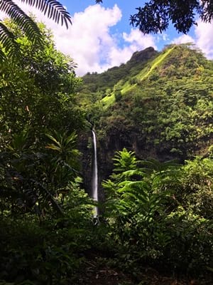
then climb for 45min to arrive at a nice viewpoint on the Loti waterfall.
Climb for another 15min to reach the old fort of Fachoda, of which only ruins remain.
Go behind the first wall of the fort, turn directly to the right to walk along it,
until you reach ropes that will allow you to descend to the basins.
Be careful, the descent is very steep!
Once down, you can admire the various basins, the slide and pretty basalt organs.
You are actually at the top of the Loti waterfall.
Loti waterfall:
For the hike to the bottom of the Loti waterfall,
leave the Fachoda bridge on your left and continue along the river.
After about 1km, cross the river for the first time to find yourself inside the bend of the river.
Walk along the other bank to follow the bend, then cross a second time to get back to the initial bank.
The river offers a few places here to enjoy some refreshing bath.
Continue to get to stairs which will allow you to climb on the bank
and to enjoy a viewpoint on the Loti waterfall.
Shortly after, you come to a small confluence.
Cross the right branch,
then take the path which goes up on the banks to the left.
Go down the path and you will find the imposing Loti waterfall,
with its high basalt walls and its deep basin.


